|
Dec 26 quake measured 9.3, twice as powerful as thought
(Agencies)
Updated: 2005-03-31 14:30
In a reassessment of the December 26 earthquake that unleashed the Indian Ocean killer tsunami, scientists say the quake measured 9.3 on the Richter scale -- more than twice as powerful as originally estimated and the second biggest quake ever recorded.
The quake split the ocean floor northward from Sumatra along 1,200 kilometers (750 miles), twice as long as previously thought, according to their research, which appears on Thursday in Nature, the weekly British science journal.
The event released so much strain along this particular part of the fault that in theory there should be no quake of similar magnitude, or a similar tsunami, there for another 400 years, said geologists Seth Stein and Emile Okal of Northwestern University, Illinois.
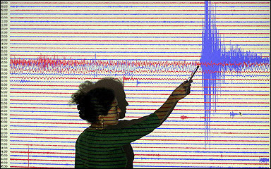
A worker at Potsdam's Geophysics Research center points to seismograph readings recorded as a massive quake struck off Sumatra's western coast. In a reassessment of the December 26 earthquake that unleashed the Indian Ocean tsunami, scientists say the temblor measured 9.3 on the Richter scale.[AFP/file] |
But farther south, it is a different picture.
The scientists -- who wrote before last Monday's quake, which also struck western Sumatra -- warned with uncanny prescience that "a great earthquake" with the potential to generate a large tsunami remained a threat south of the December 26 site.
The December 26 quake occurred off northwestern Sumatra, at the nexus where the Indian plate of the Earth's crust is sliding under a tongue-shaped sliver called the Burma microplate.
It was initially thought to be 9.0 on the Richter scale.
But an evaluation of very low frequency data from seismograms shows that the quake was in fact 9.3 magnitude.
As the Richter scale is logarithmic, the difference between 9.3 and 9.0 is 2.5 times, the study said.
"Conventional methods used to assess earthquake size dramatically underestimated it," the study said.
"(...) This makes the Indonesian earthquake the second largest ever to be instrumentally recorded."
Only one measured quake has been bigger: a 9.5 event that struck Chile in 1960.
However, that quake caused far less damage when compared with December 26, largely because the grinding plates in east Asia meet at an unusually oblique angle, causing the energy to propagate northwards along a weakened fault.
Research led by Chinese seismologist Ni Sidao of the University of Science and Technology at Hefei, Anhui province, sheds dramatic light on what happened on the floor of the eastern Indian Ocean.
Their computer model, also published in Nature, suggests that the quake delivered a high-frequency shock that lasted a stunning 500 seconds, compared with 340 seconds for the Chile event in 1960.
From Indonesia to just south of Myanmar, the ocean ruptured at 2.5 kilometers (1.5 miles) per second in an arc measuring 1,200 kms (750 miles).
The rip occurred along the so-called Sunda megathrust -- the great tectonic frontier along which the Australian and Indian plates begin their descent beneath Southeast Asia.
Stein and Okal also estimate a rupture of 1,200 kms (750 miles), and say that this figure would explain why Sri Lanka and southern India were so badly hit by the tsunami.
The reason: the biggest waves that struck their shores came not from the quake site off Sumatra, to the southeast, but from the thrust of the ocean floor to the east.
"Tsunami amplitudes are largest when perpendicular to the fault," Stein and Okal note.
The pair estimate the rupture to be some 11 metres (35.75 feet) deep and 200 kilometers (120 miles) wide.
Although the bust occurred at vicious speed, its slip was insidiously slow -- a phenomenon that proved to be ideal conditions for a tsunami.
The March 28 quake also occurred west of Sumatra, to the south of the December 26 disaster, on the same plate boundary.
Seismologists had said that the energy transmitted by the December 26 added to tension in this region and fuelled the likelihood of an imminent, very big shock. There was no tsunami in the March 28 quake, probably because the shock was much smaller and occurred beneath the ocean floor.
|