New eyeball in space peers toward Earth
 |
|
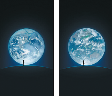
WeChat composite images: A photo of Earth taken by the crew of NASA's Apollo 17 spacecraft in 1972(left) will be replaced for three days by a photo taken by China's Fengyun 4A satellite. Both Earth images were combined with a human figure for the instant messaging app's logon page. [Photo provided to China Daily] |
Weather forecasting, disaster relief will be improved with technology
China's most advanced weather satellite officially began operating 36,000 kilometers above the earth on Monday, greatly improving the country's capabilities in weather forecasting, environmental monitoring and disaster prevention and relief. It is also expected to help China's response to climate change.
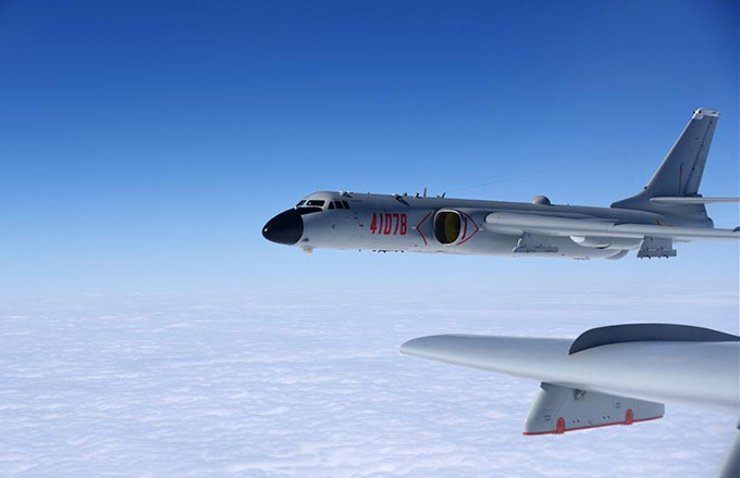
The 5.4-metric-ton Fengyun 4A, developed by the Shanghai Academy of Spaceflight Technology, lifted off on Dec 11 atop a Long March 3B carrier rocket from the Xichang Satellite Launch Center in Sichuan province.
During its shakedown period, the satellite performed well and generated good-quality images and data, according to a news release from the State Administration of Science, Technology and Industry for National Defense, which oversees the satellite project.
It said the Fengyun 4A can be used to detect and monitor typhoons, sandstorms, rainstorms and smog.
Engineers from the China Meteorological Administration took control of the satellite on Monday. It is expected to be in service for more than six years.
The Fengyun 4A is the country's latest geosynchronous meteorological satellite series and will gradually replace the Fengyun 2 generation. It will monitor the atmosphere, clouds and the space environment above China and the entire Western Pacific and Indian oceans, according to the administration.
Dong Yaohai, chief designer of the satellite at the Shanghai Academy of Spaceflight Technology, said it has four instrument groups-an advanced geosynchronous radiation imager, a geostationary interferometric infrared sounder, a lightning mapping imager and a space environment package.
He said the Fengyun 4A can calculate the density of PM10 and PM2.5-particulate matter that is harmful to human health-and is so sensitive that it can detect a temperature change of 0.1 C on the ground.
Zhao Jian, a key official overseeing the project, said China plans to launch the Fengyun 4B in 2018 and Fengyun 4C in 2020.
China launched its first weather satellite, Fengyun 1A, in 1988. Currently, the country maintains eight weather satellites-the Fengyun 4A (the newest), plus four Fengyun 2 series and three Fengyun 3 series satellites, according to the administration.
WeChat, the most popular instant messaging application in China, replaced its composite logon picture-which uses an image of Earth taken in 1972 by the crew of NASA's Apollo 17 spacecraft-on Monday. It will use an image recently taken by the Fengyun 4A satellite until Thursday.
Zheng Jinran contributed to this story.