CHINA> National

|
CHINA> National
|
|
China polar expedition mapping Antarctica
(Xinhua)
Updated: 2009-10-26 21:41
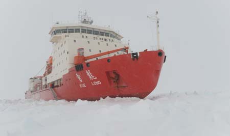
ABOARD XUELONG: Chinese scientists from the country's 26th Antarctic expedition are expected to complete the world's first land cover map of the Antarctica at the end of this year. It will be the most accurate map of the continent, presenting various land features, they told Xinhua correspondent aboard Xuelong (Snow Dragon) icebreaker in a recent interview. The research team will conduct wide range of field spectral collection on the Antarctica to provide data for the map.
Remote sensing technology is one of the most effective ways of mapping. It has been widely used in China's polar expeditions during the past decade and has made great contributions to Antarctic studies in the fields of mapping, biology research and communication. The map is also based on 1,073 remote sensing images acquired from the US satellite Landsat mainly during the austral summer from 1999 to 2002, Cheng Xiao, deputy dean of the College of Global Change and Earth System Science, Beijing Normal University, told Xinhua via email. "The precision of the map is 15 meters, about 20 times of former Antarctic maps made by other countries," Cheng said. "It will greatly advance our geographic knowledge of the Antarctica." The map will provide not only more accurate ground parameters for scientists to forecast global change or global warming with climate system models, but also important data for detection on the change of Antarctica land cover in a long run, Cheng said. The 26th expedition team began its journey on October 11 from Shanghai and sailed into Australia's Coral Sea on Sunday. A total of 251 scientists, workers and logistics staff joined the team for the half-year-long research expedition on the icebreaker. The scientists will stay on the icy continent until April 10 next year. |
||||||||